
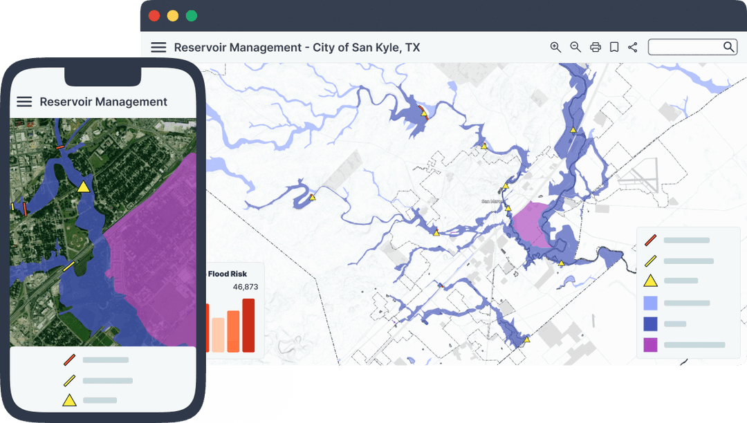
Reliable County Maps Without the Cost or Complexity
A simple, affordable GIS platform for rural pros to publish trusted maps that keep communities and committees happy.



— Trusted by counties and townships like Columbus, Plumas, and Stowe.
Used by companies like:






Affordable GIS That Works for Your Community
Annual and multi-year plans with clear costs—no budget shocks or procurement hassles.
Fixed Pricing, No Surprises
Mango cuts out ESRI’s steep licensing fees and hidden extras, offering pro-grade mapping at a fraction of the cost—perfect for budget-conscious GIS pros.
Ditch the Bloat
Swap expensive, clunky esri tools for a lean platform that gets the job done.
No need to start over
Mango integrates smoothly with your existing GIS tools and data formats, letting you dive in without wrestling new tech or disrupting your setup.
Simple, Not Self-Hosted
Publish maps fast without server headaches—reliable and ready out of the box.
Happy Residents, Happy Bosses
Deliver accurate, user-friendly maps that satisfy everyone, every time.
Maps That Solve Real County Needs
Whether you're plotting field data, wowing clients with spatial insights, or engaging the public with interactive maps, Mango transforms your everyday GIS challenges into opportunities for success.

Turn field data into interactive maps fast, making it a breeze to share insights with teams or clients on the ground—desktop or mobile.
Create E911 maps that guide first responders fast and flawlessly.
Keep community maps current with minimal effort or cost.
Build a branded, reliable portal that breezes through approvals.
What County Officials Are Saying
Real results from real counties that switched to Mango Maps

Jim R.,
GIS Pro, Columbus County
Swapped ESRI for this and cut our budget in half—updates are a snap now.
Result: Columbus County saved $12K annually and streamlined map updates by 60%.

Linda T.
Mapping Lead, Plumas County
Residents love the clean maps, and my committee's finally off my back.
Result: Plumas County boosted resident satisfaction by 40% with branded portals.

Sarah M.
GIS Coordinator, City of Dyersburg
Custom popups made our zoning maps a hit—procurement was painless.
Result: Dyersburg improved zoning clarity and sped up approvals by 50%.

Ellen W.
Mapping Expert, Town of Stettler
Accurate election maps in half the time—worth every penny.
Result: Stettler cut election map prep by 50% and kept voters informed.
Import GIS files fast—prepped and ready with no fuss.
Style and tweak portals easily—no ESRI headaches required.
Publish trusted maps to your site, keeping everyone happy.
Add new data as it comes in. Mango syncs updates instantly across all maps, keeping your work fresh without extra effort.
Track every project in one place. Add team members, tweak access, and stay in control—no clutter, just clarity.
Stakeholders love the accessibility and reliability. You save time, they stay impressed—building trust that grows your reputation.
How’s the pricing work?
Fixed annual and multi-year plans—no surprises, perfect for county budgets.
Do I need to self-host?
Nope—fully hosted, no servers or IT woes.
Can I brand my maps?
Absolutely—custom logos, styles, and domains included.
Will residents like it?
Simple, accurate maps keep end users satisfied.
Does it fit procurement?
We know the procurement lifecycle, and can work with you from go to woah. Bank transfers and annual billing make it committee-friendly.
Is it fast to set up?
From data to live map in hours, not weeks.
Is it better than pricey GIS suites?
Cheaper, simpler, and tailored to small-town needs.
What if I need help?
Your dedicated account manager is on hand to help you.
Trustworthy Maps Without the Price Tag or Hassle
Say goodbye to ESRI’s cost and complexity. Our affordable, no-fuss platform delivers branded, reliable maps that satisfy residents and committees alike—saving you time and money.