A desktop or server-based GIS are commonly used by organizations to store, manage and analyze geospatial data. However, they provided limited scope for sharing maps within an organization or the public. This is the strength of an Online GIS.
The goal here is not to completely replace Desktop GIS, but to leverage the strengths of each system to bring maximum benefit to an organization and customers.
One of the main considerations is how to ensure that updated data stored in a Desktop GIS is also available in your Online GIS.
Having your colleagues or the public take decisions based on outdated information could lead to costly mistakes.
Having up to date information at all times is crucial to the function of the organization.
Mango takes the pain out of synchronizing your offline GIS data with your online maps and data with a couple of easy to configure tools.
Data Re-upload
The first method, “Data re-upload” is a manual process suitable to situations where data changes infrequently and you want to have full oversight of the update process.
For example, if you have quarterly or annual updates to apply, then this tool is perfect for that process.
By simply locating to your dataset in Mango, you can click the Re-upload button, browse to your data and select the new files.
Once the upload is complete, your maps will automatically update with the new version of the data.
We have inbuilt validation tools to ensure the integrity of your data in Mango to ensure that nothing goes wrong in the re-upload process, thus giving your peace of mind when applying important updates.
The main benefits of this tool are;
- Update your background data without having to touch your web maps
- Automated checks and validation during the re-upload process
- Save time when applying data updates to your Online GIS

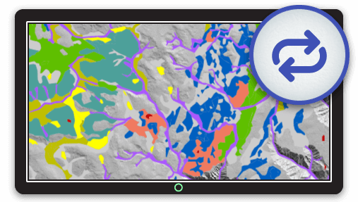
Automated Data Sync
Imagine — you work on your data in your desktop GIS, and magically, your web maps just.. update.
Why work harder when you can work smarter?
Synchronizing your offline GIS data with your Online maps is a key challenge to address when choosing and setting up an Online GIS.
Yet most solutions out there cost an arm and a leg and normally require an enterprise database and enterprise GIS on top of it, both of which are complicated to setup and costly setup and to maintain.
That’s where our Data Sync tool comes into the picture.
This tool is suitable in cases where the data is updated frequently and the manual re-upload would become too time-consuming.
Data Sync lets you do complex work on datasets in your desktop GIS or spreadsheet application, and have changes updated on your web maps, without even logging into Mango.
After an initial data upload, simply point to a Dropbox folder containing that data and link it to Mango.
Any changes to the data stored in Dropbox will automatically upload to Mango and update on any maps using that data.
This tool is a great time saver and gives you peace of mind that your users are always seeing the most up-to-date information in your maps. The main benefits of the tool are;
- Does not require a complicated back-end database to ensure data sync
- Does not require expensive server software
- Very easy to setup and administer
- Automated notifications if issues are encountered.
- Never have to worry about whether your Online GIS maps are out of date
Your core data need not be stored in Dropbox, you can simply copy and paste new files to that folder or write a script to export from your spatial database of choice to that folder.

These two tools provide a way to update your data from a desktop/server environment to an online environment.
Of course, you can also go the other way; if you are editing or updating data in Mango, you can download that data in a spatial format and use in your offline environment.
This gives you full access to your data to use it in your chosen Desktop GIS and giving your full flexibility and choice in which tasks you perform in which environment
Additionally, Mango offers a number of possibilities to integrate your information stored in an external database such as a property deed or tax information with your online maps. You can read more about this here.