“What immediately impressed me was how quickly I was able to upload data and get a useful map published. Other products I tried required more time in the learning curve than I could afford.”
—Alan James. Director of Management Information Systems, Columbus County, NC
Columbus County in North Carolina is the third largest county in the state, home to nearly 60,000 residents. Services are provided to citizens of the county across a variety of departments from Emergency Services to Animal control.
The county maintains a wide range of geographic information to support delivery of these services and provided access to information to citizens and the private sector.

Like many counties, Columbus County has been using GIS for many years, preparing maps and reports to those requesting them, using desktop software and databases to store and manage the information. The information in these databases changes daily, whether it be the record of deed transfer on a property or the re-surfacing of a section of road maintained by the county.
Making sure everybody has access to the latest information is crucial for functions including asset management, tax assessment and planning to name a few.
The challenge therefore, was how to deliver such information to end users via the internet, tapping into existing systems and databases in a secure, easily maintained manner?
Enter Mango.
Alan James from the County’s Information Systems department led the search for a Web GIS that would provide such functionality and deliver the benefits of open, accessible information to county stakeholders.
The county was seeking to replace an older server based system that, according to Alan was antiquated, expensive to maintain, and lacked the functionality of more modern systems such as support for modern browser, support for mobile devices and the assurance of availability in the Cloud.
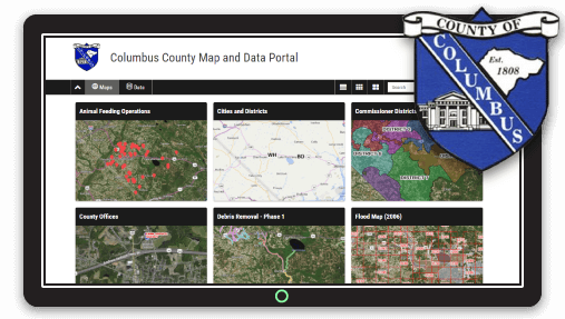
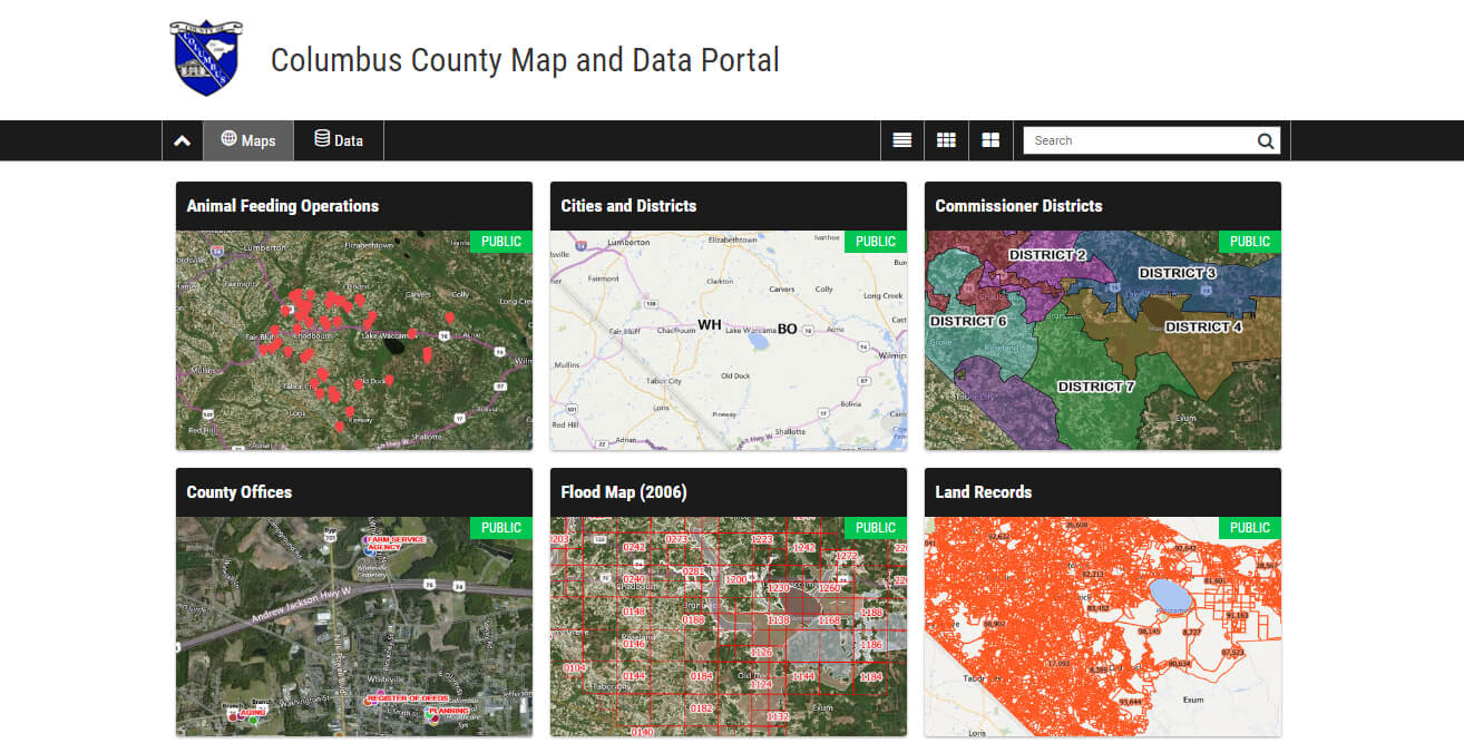
Experienced with traditional desktop GIS software, Alan cites the “simplicity, ease of use and short learning curve” as key reasons he initially was drawn to Mango. Working with various departments Alan was able to develop around a dozen thematic maps, each focused on a particular service area from Land Records to Flood Mapping to School Districts.
Gaining early traction and support by other departments for the maps Alan was able to deploy the map portal and make it accessible on the county's website.
Due to the attractive pricing, he was able allocate existing budget and deploy the system without having to get high level approval or wait for the next budget cycle.
In addition to uploading and publishing their own GIS data, Columbus county was also able to tap into other systems and integrate the content in the maps. For example, they were able to add current, high resolution aerial photography from the “NC OneMap” initiative as a WMS layer. This gives user a bird's-eye view of what's happening “on the ground” across public and private land.
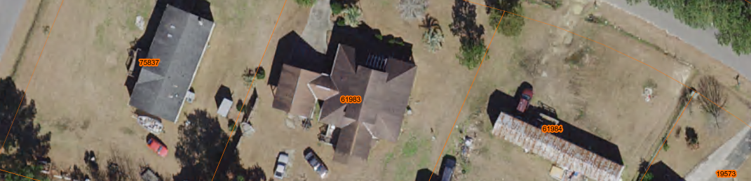
Another example is linking to documents from the County’s other databases, including electronic copies of tax statements, deeds and property cards - all in the one place!
A customer of Mango for over three years now, the proof of success—as they say—is in the pudding!
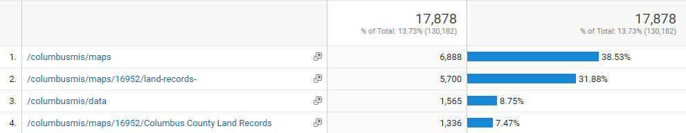
The Columbus county’s Web Map portal has been a huge success, with over 17,000 views a month, coming from citizens, county staff, appraisers to name a few.
And Columbus County is not stopping there…
With the ever increasing demand to map-linked information, the county is looking at deeper integration of Mango into their property parcel database to allow users browsing the conventional database to view that record on a map. And you can expect to see more tweaks and improvements to come!