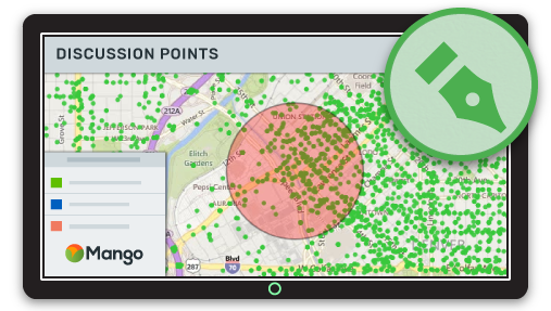
Conversations about location and place that were previously impossible are now simple, allowing for rapid consensus building and faster decision making.
Collaborating on documents by several people at the same time is a task familiar to many of us, and is commonly found on platforms such as Google Docs, Etherpad and Office 365.
Gone are the days of versions and reviewing and merging edits from multiple documents into one.
The same is true of Online GIS, where collaborating and communicating on top of a map using drawing tools is now possible. Sketch overlays on web maps can be stored, shared, modified by, and contributed to, by anybody who has permission to access the map or sketch.
Gone too are the days of scratchy markings on top of a screenshot sent from inbox to inbox.
With map sketch, those old ways are becoming obselete, and now data-driven decision making and collaborative problem solving can be achieved faster and more accurately than ever, all without having to “mess up” underlying data.
What makes a great map sketch tool?
As a highlighter for your maps, a great sketch tool needs to have a number of important features to be really useful.
The first is to allow you to draw on a map without affecting the underlying visualizations.
A sketch is a psuedo layer, distinct from a map's underlying spatial data. This means any number of revisions and improvements can be made collaboratively, without affecting the source data.
Geometry
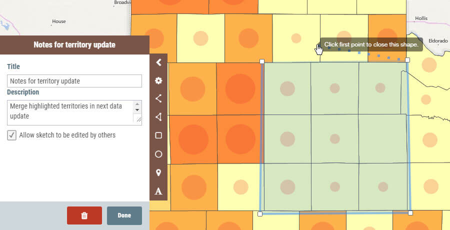
A great sketch tool will allow users to draw different types of shapes including polygons (freehand, squares, circles), lines and points on top of the map.
Different features on the map need to be drawn differently: an important area or study site needs to have a polygon boundary; a new road or route is best indicated as a line. Locations of events or findings are best represented by points.
Text
The ability to add text noted to the map is crucial to communicate with others. What are we trying to show? What question are are we asking them to answer? Do they have something to say about our proposal? This communication is made possible with map text that can be placed around our areas of discussion.
Style
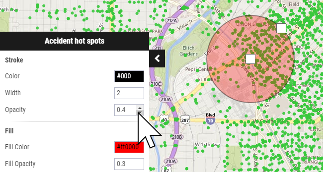
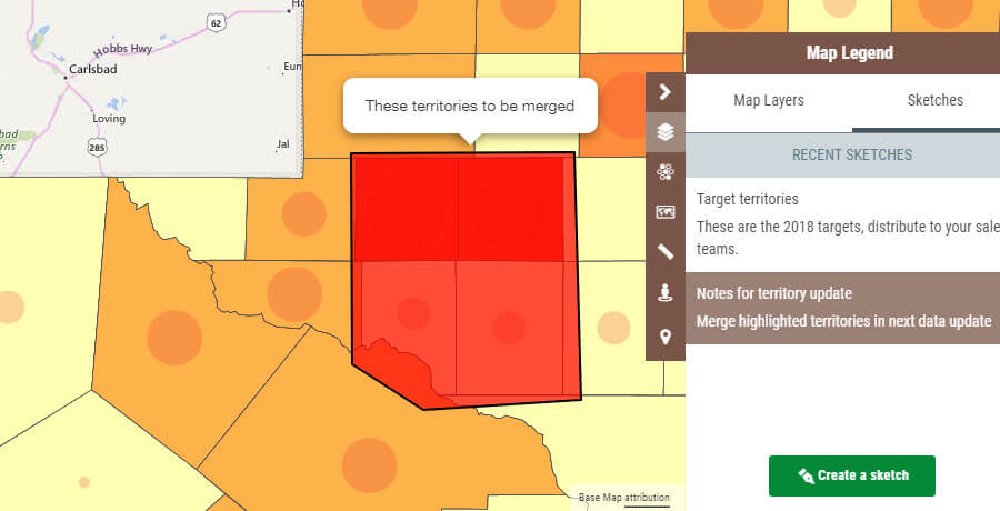
Since sketches represent real features in the real world, we need to have the ability to stylize them to indicate what they are. A lake might be blue. A contaminated or restricted area might be red.
We can also build up our sketch to have many shapes, each colored according to what is represented. This will allow for rapid visual identification and lead to understanding of the message.
Naming
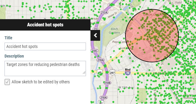
We should have the ability to name and describe our sketches and organize them into separate groups. Users can then identify the correct sketch to work on or flip to the next sketch as required. Names and descriptions allow us to clearly indicate what the sketch is about and what its purpose is.
Access Control
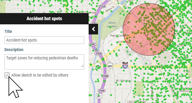
A great sketch tool should have full control as to who can view the sketches, and who can edit them.
For internal or sensitive collaboration, sketches should only be visible to those who have permission to view that map. We should be able to specify whether or not authorized users can modify the sketch by editing it or adding to it.
At the other end of the spectrum, sketches can be made public, visible to all.
Maybe we need to highlight something on a map as part of a community consultation process. The sketch could contain links to a feedback form to allow capture of comments from the public.
Taking the concept one step further, members of the public should be able to create their own sketches, perhaps highlighting a particular issue and communicating this to others or the map owner. This opens up the possibility of crowdsourcing information from a larger group of “eyeballs” and contributing to better outcomes in communities.
Sharing
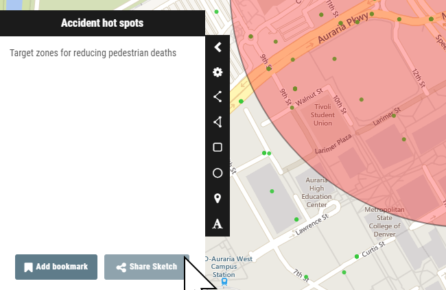
Sketches should be easily shareable via a unique URL so that we can prompt a colleague or collaborator about a particular issue and elicit their feedback.
The tools are easy to use by non-expert users and allow the creation of location specific information without having to get into the heavy side of GIS.
Furthermore, sketch overlays are given context of data visualizations, without giving full access to the underlying spatial data, ensuring its integrity and the maintenance of private or confidential information.
All in all, the ability to sketch on a webmap is an effective and powerful way to quickly and selectively communicate with others around maps and location.
The best part is, awesome sketch tools are available right now in Mango, ready for you to test drive with your team.
Simply sign up a free trial and get sketching today!
