Once upon a time, all maps were printed. Now we are firmly in the digital age and web browsers and mobile devices are the new de facto home of our maps it's easy to overlook the importance of print. But this is a mistake.
Print maps may no longer be king of the hill but they still have their place and offer some important benefits over a web-based map. In this article, I'm going to show you why print maps are still important.
1. Printed Maps Work Offline
Web maps are great and offer huge usability benefits over a printed map, but what happens why you lose internet connectivity?
Some maps can work offline, but that feature often involves the forethought to locally cache the area of interest.
A printed map isn't reliant on the internet God's smiling down on your today.

2. Printed Maps Still Work During a Zombie Apocalypse
The cellphone network is down, the electricity grid is offline, the Apple Store is closed and bands of the walking dead are hunting down the living.
All of your electrical devices are now nothing more than over-engineered paperweights and are not going to help you find a zombie-free route to NORAD.
Luckily you already prepped for this and have a stack of printed maps in your bunker next to your iodine tablets and shotgun cartridges.
Provided you keep your printed map dry, avoid setting it on fire, and keep it clear of zombie gore, it's pretty resilient.
Just fold it up, put it in your pocket and you're back in the game.
4. Printed Maps Can Be Included in Reports
We all hate them, but we all know for industries that are the heaviest users of mapping and GIS old-fashioned paper-based reports are still part and parcel of everyday life.
A printed map can easily be included in reports and a PDF export can also be included in the digital version.
You can guarantee that if your report includes a link to the web map, the office internet will drop out at the very moment you bring up your web map that visualizes the report's most important findings.
4. Printed Maps Can Be Very Big
I know, I know. Everyone has already told me that you have a massive monitor. But I bet you that it's not as big a sheet of paper from my A0 plotter!
And maybe it's just the map nerd in me talking, but every office looks serious about their business when they have massive maps mounted on the walls.
5. Printed Maps Look More Important
For those of us born before 1985, paper maps fall into that special category that also contains hardback books and handmade furniture. They have a special value that's hard to describe to the digital generation with their Kindle's and Ikea catalogs.
Picture the scene, a group of well-dressed professionals standing around an office meeting table engaged in deep discussion over the printed map that's laid before them.
Then compare that to a group of casually dressed staff huddled together and squinting up at John's iPhone screen as he attempts a series of swipes, pinches and muted swear words.
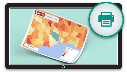
Make Awesome Printed Maps with Mango
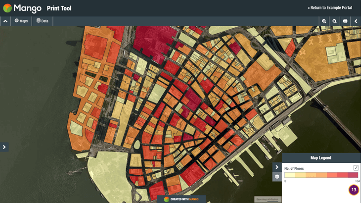
Most web mapping systems fall short when it comes to their print tools. That’s not the case with Mango, our highly configurable print feature offers the following benefits:
- Full control of the layout
- Add a title and description
- Full legend
- Easily add a scale bar and north arrow
- Selected features and attribute data are included in the print
Don’t just take our word for it, go and give it a try for yourself, take a look at this print created with Mango or try creating your own print on the sample map below:
Mango makes it easy to create stunning and fully featured web maps without writing any, needing any server or requiring any expensive software licenses.
