Web maps and search go together like bread and butter. The design of your search feature is critical for your web map as the first thing your users want to do is find their starting point. And it’s something that most web maps are doing wrong.
The starting point might me your current location or it might be an area of interest. Can you remember using your trusted road atlas map before the days of smartphones and the GPS?
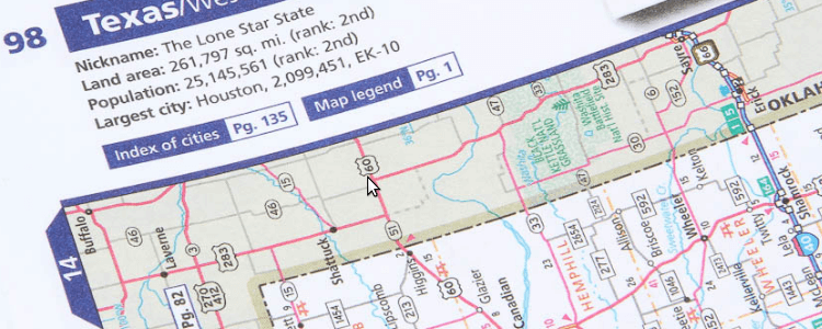
We would pull it out of the glove box, go the index at the back and look for the name of the nearest town or village to what we were looking for. There you were presented with a page and a grid reference and then you spend the next few minute straining your eyes trying to find the proverbial needle in a haystack of tiny place names.

Okay, I'll admit as a map maker those old highly detailed road maps do invoke a feeling of nostalgia, but not to the point where I would start using them over a digital map on my phone when finding the way from A to B.
Say what you want about those old maps and their efficiency, at least they had a very clear and repeatable workflow, that although slow and cumbersome got the job done. Unfortunately, modern web maps often get this important functionality very, very wrong.
The Common Problems with Search for Web GIS
Obviously Google Maps does a great job of search, but we're not in the business of placing points of interest on a road map are we? We're in the GIS game and I think you’ll agree that GIS web maps are often found wanting when it comes to the efficiency and ease of use when it comes to search.
In many cases we aren't even offered a search box, we are expected to know where to find our place of interest and get there through a series of pan and zoom gestures. Nearly as bad are the form based search features where we have to select an attribute column from a drop down and then type in an "exact match", which is often an exercise in futility.
Your web map search shouldn’t require the user to:
- Rely on pan and zoom
- Use a complicated interface
- Have pre-existing knowledge of the data and its structure
- Type the entire word correctly or provide an “exact match”
- Behave like a desktop GIS
Web map search has to be better than this! It requires the simplicity of Google where, as we type, we are presented with results in real time. What's more, we don't only want to search by address, as this is GIS we also want to search by attribute values or even coordinates.
So what does a great web map search feature look like? How does it work?
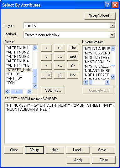
At Mango we have spent a lot of time and energy thinking about how GIS search should work. Before we look at what your search feature should do, let’s look at what it definitely shouldn’t do; behave like a desktop GIS.

“Ouch...”
The desktop GIS expects too much from the user, it expects knowledge of a complicated search workflow in an overwhelming (to the uninitiated) interface and knowledge of the data and its structure, this is too much of an ask for a web map user.
Search for Online GIS Done Right
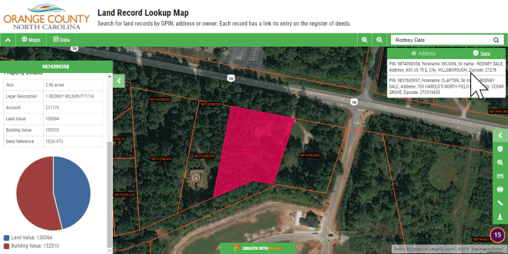
We designed Mango with a single search box in which you can type an address, attribute values or coordinates. As you type you are presented with results and the results are refined with each new character you enter.

What's more Mango knows the area currently visible on your map and will prioritize results within that area. Often you will only need a few key strokes for Mango to correctly guess what you are looking for and present it as the top result.
When the user clicks the result the map will zoom to that location, highlight the feature on the map and open a popup window to display the attributes for the chosen result.
This behavior default behavior can be configured by the map administrator, and you are free to completely customize the search feature to match your requirements.
Don't need coordinate search? Fine, it can be disabled. Only want specific layers to be searchable? Easy, select which layers are searchable. Don't want the highlight and popup to display when a result is clicked? It can be deactivated with a single click.
So a good search tool will:
- Suggest results as the user types
- Allow the user to search by address, attribute, or coordinates
- Allow the user to search across multiple layers and columns simultaneously
- Not require an “exact match”
- Zoom to, highlight and display the attribute data for the selected result
What the Data Says
Search is by far the most important tool on the map. This isn't my opinion; this is a fact backed up by hard data.
At Mango to ensure the best user experience possible we track map user actions from start to finish and our data (consisting of more than 60,000 maps) shows us that by far the most common workflow when interacting with a web map is:
Load → Search → Display Popup → Print
Get the Job Done in Just Four Clicks
It's for this reason that we have put so much work in simplifying this process for the users of your maps. With Mango your users can complete the workflow in only four clicks!
Here give it a try for yourself. Try searching for a parcel owned by “Rodney Dale”:
That means in only four clicks your users can go from clicking the link to your map, to having a PDF download of what they're looking for, complete with the feature highlighted and the attribute data on display.
What's more, you can achieve these same results for your users without writing any code, needing any servers or paying for any expensive software licenses.
With Mango you can create a map with your data and implement our search tools in a matter of minutes using nothing more than your web browser and our super simple map administration interface.
Want to check out our search feature for yourself? Why not sign-up for a free 30-day trial and take it for a free test drive. You'll be amazed at how simple it is.


