Many organizations operate with locations with defined territories, but a surprising number are very vague about the size of such territories and, more importantly, whether they’re viable. The traditional approach to location has been simply an address with a fixed size radius as a territory or exclusive area. This approach is a legacy of a time when digital maps and mapping were much more inaccessible (read expensive and complicated) to the average business.
And while commercial real estate search companies can provide a detailed picture of a particular site, a broader view is often required by taking a city wide, strategic approach to locations and territories.
Two significant developments now mean that there’s no longer any excuse NOT to up your territory mapping game beyond a spreadsheet and Google My Maps.
1. Free, High-Value Data
The unprecedented availability of a wealth of information from national statistical agencies, which includes population census, businesses census and community surveys, is game changing. These surveys provide essential demographic information about a location, including population, number of households, income, and employment. Many of the surveys go even deeper and answer questions such as: How many people in this zone have private health insurance? How many businesses are there in this area? What is the daytime working population of this area?
This data is largely free, open, and ready for the taking. Those not taking advantage are seriously missing out.

2. Cloud-Based Software to Access Deeper Insights
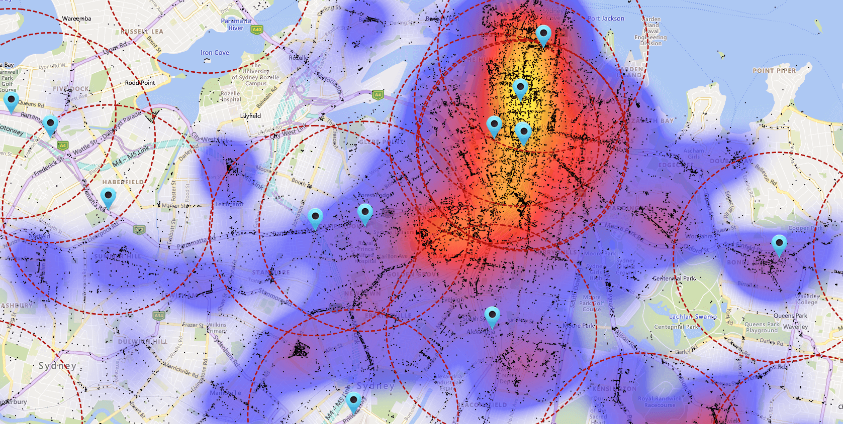
The second significant development is the advent of cloud-based software solutions that allow the visualization of this information on a map, to support processes such as territory planning. Map-based territory planning ensures that territories are not too large or not too small, and therefore unviable. It also ensures that you include enough people of the target demographic, are compact and accessible by residents, avoid conflict between adjacent territory owners...and the list goes on.
By combining high-value data from free, open sources and leveraging the cost effectiveness and security of the cloud, territory mapping solutions are now more cost effective than ever before and accessible to franchisors who operate in one city or nationwide. These applications are also incredibly easy to learn and use and many franchisors have looked back and wondered why they did not utilize such solutions before.
One of the key benefits to creating a territory map that can be shared with franchisee candidates is that it makes everything more transparent, the boundaries and demographics of the territory are clear. This means that franchise candidates have more confidence in their investment decision, leading to shorter sales cycles and, ultimately, more franchise sales.
MangoMap is the leading franchise territory mapping solution in the world, servicing hundreds of companies including F45, Anytime Fitness and many more. We have a dedicated team who can help you get you started immediately, whether that's a self-serve option or a complete solution, including fully mapped out territories from our territory mapping team.
To find out more, please get in touch at sales@mangomap.com and one of our team will get in touch to help you find the best solution for your needs.