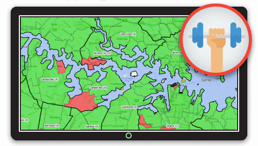
Creating Territories from Existing Administration Boundaries
The fastest, simplest and most cost-effective way to define franchise territories is to use existing administrative boundaries, such as zip codes, townships or states.
We live in an age of open data where most governments let you download administrative boundary information for free. This means you can easily access data that contains the geographical boundaries of a given area, which can quickly be pumped into a mapping system to create a collection of territories. You can then add relevant socio-economic census data, such as population, average earnings and age, to provide insight into a territory’s potential market.

Most governments offer a hierarchy of boundaries based on population or geographical areas. The following are commonly used administrative boundaries for the US:
- States
- Counties
- Towns/Townships
- Municipalities
- Zip codes
Which administrative boundary is right for you?
The type of administrative boundary you choose is driven by the goals of your business and the best natural fit regarding population and geographic area.
For example, a franchise business that delivers specialized services that are high cost and low volume, such as private jet charter, would more than likely choose a state-level system.
In cases where the business delivers lower cost, higher volume products or services, such as garden maintenance or gyms, it might work best to have smaller territories like townships or zip codes.
Although easy to set up, the main drawback of using existing administration boundaries is that there can often be a great deal of variance between each area in terms of geographic, population and socio-economic factors.
If your business offers artificial lawns, then territories in urban areas made up of condo units and high-density housing would likely not be of much interest to potential franchisees.
The other problem with administrative boundaries is that they often have low levels of uniformity, such as California with 40 million residents and Washington State next door with only 7 million.
There are strategies for overcoming these issues, such as splitting and joining territories, that we will look at later in the article in the Hybrid Approach section.
On the plus side, the boundaries are familiar to everyone involved and require no explanation, and though this may seem like a small detail at first glance, it can often prove quite important during sales discussions.
| Pros | Cons |
|
|
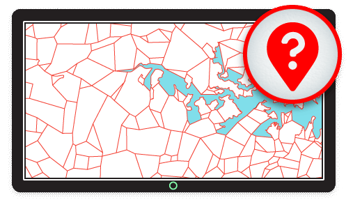
Custom-Built Boundary Areas
The approach at the other end of the spectrum is to start by defining exactly what your ideal territory should look like.
For example, your desired territory could be:
- 100,000 - 150,000 total population
- 50,000 - 60,000 females aged 55 years or above
- 10,000+ high income households
In such a case, you’ll likely need to hire a mapping company to prepare the data for you. They will begin with a large dataset containing very small administration areas and their associated census data. They will then build an algorithm to combine these smaller areas into larger areas that match your exact requirements.
![]()
This approach will give you territories with a high level of uniformity and, in theory, a lower variance in sales potential, which means your sales process can be more uniform. This approach, however, can come at a cost that isn't only measured in dollars.
These custom-built territories can often slow down sales interactions with potential franchisees, as the first part of any sales conversation must focus on communicating where a territory is. This can prove to be complicated if it spans several neighbourhoods or if the territory has a natural division running down the middle, such as a river or a railroad. Of course, such issues can be ironed out, but expect costs to increase.
And let's face it, if you owned a franchise would you prefer to tell the guys at the golf club that you own the franchising rights to "West Hollywood" or "Electoral tracts 87080, 87046, 87523 and 50780, which are spread across Hollywood, Fairfax and Little Armenia?
| Pros | Cons |
|
|
Hybrid Approach
This is a middle ground to the two methods above. The Hybrid Approach works by starting with well known administrative boundaries and joining or splitting them where appropriate.
For example, you could split a populous territory like California into several smaller territories, while joining less populous territories like Idaho, Montana and Wyoming together.
This approach makes it easier to maintain the demographic data when joining two areas together, as you can simply add numbers together until you get the desired result. It becomes trickier when splitting an area, as you want to know exactly how the demographic data can be divided between the two areas.

A way around this is to divide an area along the lines of administration areas contained within it. For example, you could split California down the middle along county lines, then add the demographic data for each of the counties within the new area to get the new demographic totals. It’s slightly more complicated, and requires a deft touch, but it can be an effective workaround.
| Pros | Cons |
|
|