Agriculture in the Central Valley, California
Click on the map to view information about crop production
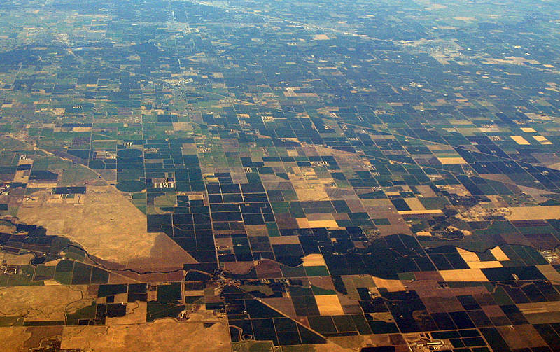
California's Central Valley is a large, flat valley that dominates the geographical center of the U.S. state of California. It is 40 to 60 miles (60 to 100 km) wide and stretches approximately 450 miles (720 km) from north-northwest to south-southeast, inland from and parallel to the Pacific Ocean coast. It covers approximately 22,500 square miles (58,000 km2), about 13.7% of California's total land area (slightly smaller than the state of West Virginia). Bounded by the Sierra Nevada to the east and the Coast Ranges to the west, it is California's single most productive agricultural region and one of the most productive in the world, producing more than half of the fruits, vegetables and nuts grown in the United States.[1] More than 7 million acres (28,000 km2) of the valley are irrigated via an extensive system of reservoirs and canals.[2] The valley also has many major cities, including the state capital Sacramento; as well as Redding, Stockton, Modesto, Fresno and Bakersfield.
counties_resel_w_stats
 CREATED WITH
MANGO
CREATED WITH
MANGO