Instructions
Step 1: Determine which Zone(s) the data your require are in (if your area of interest spans more than one zone then you will need to follow this process again for each additional zone):
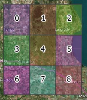
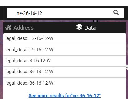
(to locate a section or quarter section, type the legal description into the search box, e.g. "NE-7-7-7") :
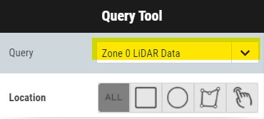
Step 2: Click on the Query tool:

Step 3: Select the required dataset to query (i.e. the Zone your required data are in):
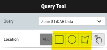
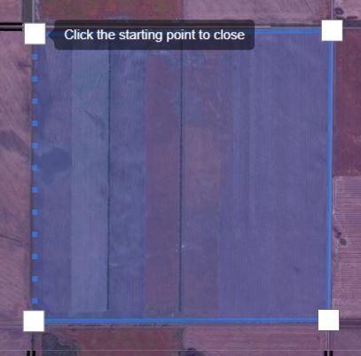
Step 4: Use the drawing tools to draw around the area you require. Click Get Results:
Click OK if you get a warning (this is just because we are selecting too many data points to display on the map)
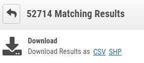
Step 5: Download the LiDAR data points in either Shapefile or CSV format as desired:
***FOR LARGE AREAS PLEASE BREAK DOWN YOUR QUERY TO A MAXIMUM OF ONE SECTION (~640 ACRES) PER SEARCH/DOWNLOAD. TRYING TO SELECT LARGER AREAS THAN THIS MAY CAUSE THE QUERY TOOL TO TIME OUT AS THERE WILL BE A SIGNIFICANT AMOUNT OF DATA TO SELECT***
You may also download the data for each entire zone (large files) from the Data Portal

LiDAR Bare Earth Elevation Data Download
LiDAR Elevation Point Data at 7m (23ft) Point Spacings
Download data in either ESRI SHP (WGS84 coordinate system) or CSV (with decimal degree coordinates)