How to use this map
This map contains store locations as pins and population and income data by census tract/census sub division.
- Click on a tract to view the demographic information for that tract
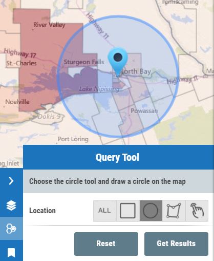
- Choose the Query Tool and draw a radius around a point to summarize multiple tracts. Then choose Get Results -> Generate Report
Plan a new location:
- Type an address e.g. Niagra Falls
- Draw a circle with 10km radius
- Generate a report
Canada Territory Planning Map
Map for Demonstration Purposes Only
Locations
Schools
Population by Census Tracts
Center your desired location under the cross hairs and click the launch streetview button.
Measure distances
Measure areas
 CREATED WITH
MANGO
CREATED WITH
MANGO
CREATED WITH
MANGO
Selection Table