Overview
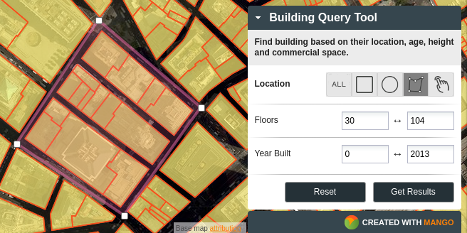
The Query Tool allows users to rapidly dive into your data with rule based queries to discover features of interest contained within your map. Features that match the query will be highlighted on the map, and users are able to view results as a table, download a spatial file of results, or view an on-screen report based on pre-configured reporting widgets.
How To Use
First the user makes their selection based on the location of features, but either selecting all, some or drawing a box, radius or shape around specific features. The user can further refine their selection set by setting filters based on the attributes of the selected features.

In the results the end user has the options of viewing a custom report containing aggregate data of the matching results, viewing the results in a table or downloading the data for use offline. All of the options for the query and the results page can be configured within the tool settings.
How To Configure
From the administration area of your map the query tool can be activated from the toolbox panel in the administration toolbar. See the following section in the documentation for more details.

